Sunday, April 26, 2020

Asbestos Mountain

Hiked: 4/24/2020
Distance: 3.3 miles round trip on trail and cross country
Summit Elevation: 5265'
Prominence: 1265'
Elevation Gain: 1088'
Elevation Gain (in Empire State Buildings): 0.8
Round trip time: 2 hours 35 minutes
Recommended water: 48 oz.
Parking/Fees: Free on Jeraboa Road
Difficulty: Easy

After Desert Angel, I looked at a few options in the area and settled on Asbestos Mountain. It was a short hike to an HPS peak (#257) and I thought I could complete the hike and be home early enough to pick up dinner. I drove up to highway 74, then went south toward Mountain Center. The trail starts at the end of Jeraboa Road. I stopped after the last intersection, but could have driven a bit further. I didn't mind the extra hiking.

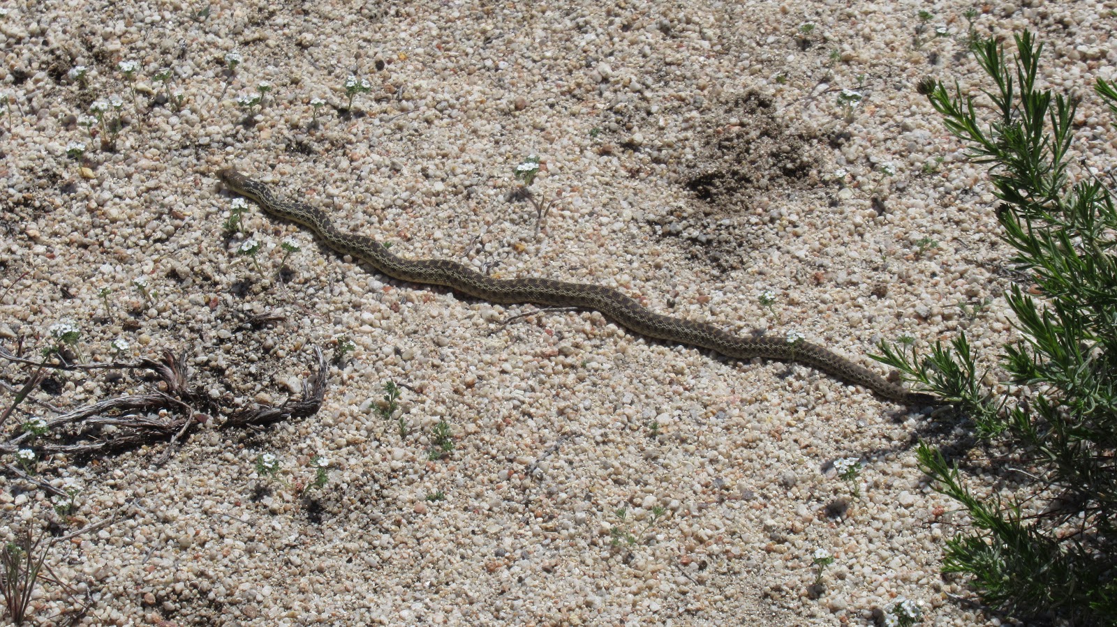
I followed the road to the end, then tried to decide between the ridge line and a more direct approach. With no prep, I didn't know where the HPS route was or the summit. There was deep saddle along the ridge so I went more directly toward Asbestos Mountain. I didn't spot a use trail on the way to the base, but it was easy to dodge the light brush. I started up not quite sure where I was headed, pausing once to let a swarm of bees move up the mountain. After a couple hundred feet, I noticed a wide gully to the left that might offer an easier way up. I scrambled to the gully and was pleased to find a set of cairns. I had stumbled on the HPS route and followed the cairns up the gully. When it leveled off near the top, I was staring at 3 possible peaks that could be Asbestos. I broke out my phone and pulled up a trip report with a GPS track. That cleared up which peak to chase. Class 2 was required to reach the summit where several register books were stuffed inside a pair of red cans. I also found the benchmark. I enjoyed a second set of amazing views on the day. I had an easier time following the complete HPS route on the way down. I came across another swarm of bees, hovering around a hole in some rocks. I was about 100' away and was careful not to get any closer. No other people were around the entire day. From the HPS page: "Named for the large asbestos deposits in the San Jacinto Mountains that were first mined in 1888".


High point not visible at start


HPS route goes left of the large outcrop


Following cairns


Passing left of the outcrop


Approaching Asbestos summit


Scramble at the end


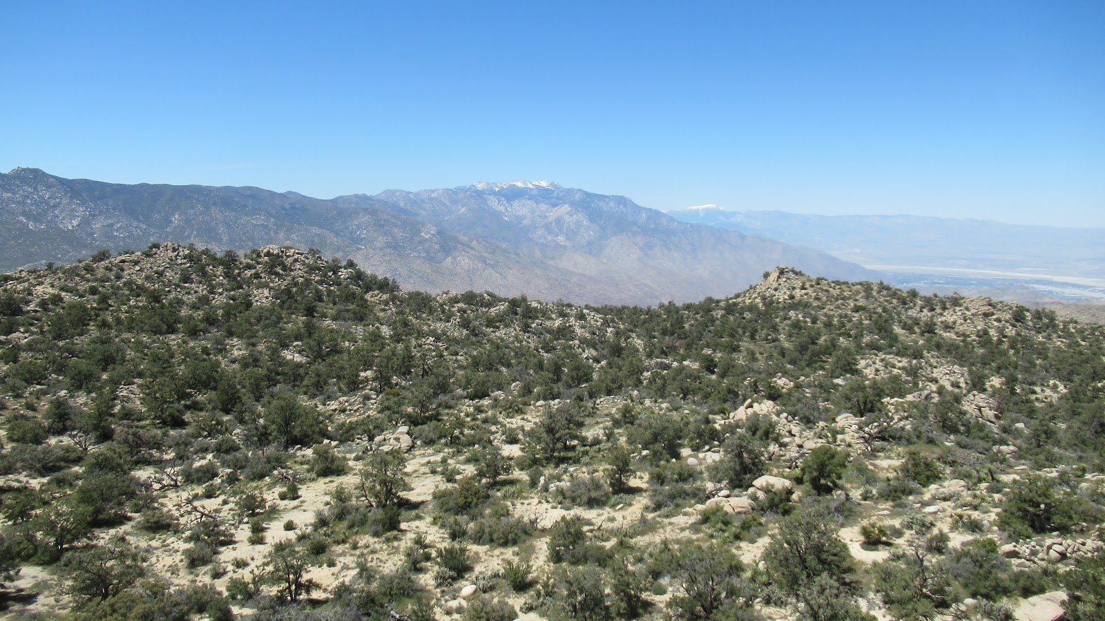
San Jacinto front, Gorgonio in the distance


Toro Peak


Odd "base" benchmark near the bottom of gully


Saturday, April 25, 2020

Desert Angel

Hiked: 4/24/2020
Distance: 2 miles round trip cross country
Summit Elevation: 2356'
Elevation Gain: 1597'
Elevation Gain (in Empire State Buildings): 1.2
Round trip time: 2 hours 40 minutes
Recommended water: 48 oz.
Parking/Fees: Free at turn out off Highway 111
Difficulty: Moderate

Another day looking for summits on BLM land. My first goal was Orocopia south of I-10, but Riverside County had blocked the roads to the trailhead. I could have driven around the barricades, but chose to follow the rules (this time). My other goal for the day was Desert Angel, a peak at the end of San Jacinto's mighty Leatherneck Ridge. There was only one ascent of Desert Angel in Peakbagger by Mark McCormick, but no report. It looked like the best approach was directly up the ridge, about 1600' gain in less than a mile. I parked in a dirt turn out just off highway 111 where I could barely see the snow capped upper reaches of San Jacinto.

I took a side hill angle to the first saddle, then continued directly up the first bump. The terrain was mostly open with grass up to mid-calf. Nice boulder formations dotted the landscape. After a second smaller bump, the steep ascent to the summit came into view. Near the top, there was some slab work and class 2 scrambling to reach the summit area. I stayed left below the ridge to avoid dangerous drops to the desert floor. On the summit, I found a metal pole with a flannel shirt attached as a flag. The summit boulder was a 10' class 2 cylinder. No marks and no register. Views were wondrous in all directions. Palm Springs spread out to the north and hundreds of giant wind towers were lined up below. The wind was gusty but not steady and it really started to warm up on the way down. It was a slow descent, taking roughly the same amount of time as going up. Desert Angel was quick fun but hard on the knees. Once I got down, I started searching for nearby peaks to substitute for the missed opportunity on Orocopia.


Start of the ridge


Clear view of the summit


Summit area


View from summit boulder


Looking toward Palm Springs


Flannel flag


Truck visible below


Tuesday, April 14, 2020

Pepperwood Peak and Bow Williow Peak

Hiked: 4/12/2020
Distance: 11.2 miles round trip on trail and cross country
Summit Elevation: 4436' (Pepperwood), 4553' (Bow Willow)
Elevation Gain: 1435'
Elevation Gain (in Empire State Buildings): 1.1
Round trip time: 5 hours 10 minutes
Recommended water: 80 oz.
Parking/Fees: Free on McCain Valley Road
Difficulty: Moderate

It was Easter Sunday and I saw Jesus. Well, I saw "a" Jesus, not necessarily "the" Jesus. Back to that in a second. During the present dystopian pandemic, all state and county parks were closed and many national parks as well. Itching for a hike, I had trouble finding mountains that were not closed and where I would not run into people. I scouted some Bureau of Land Management parcels south of Anza-Borrego in San Diego County. Pepperwood Peak was on BLM land, while nearby Bow Willow was technically just inside the Anza-Borrego boundary.

I started south on I-5 around 7 AM and saw Jesus standing on a pedestrian bridge in San Clemente. He had long hair, white robe, staff in his left hand and was waving at the seven cars on the freeway. I watched him for 20 seconds and he seemed real but maybe he was just a robotic Jesus set up by someone for Easter. Either way, this is why I love California.

I drove as far as I could on McCain Valley Road until the dirt road became too deeply rutted from rain. I parked near some of the giant high tech windmills generating electricity. No other cars were around. It rained the entire drive but the clouds were blocked by the Laguna Mountains and patches of sun and blue sky greeted me at the trailhead. I hiked to the end of the road, then picked up a single track trail heading north toward Pepperwood. There were several side trails as the path curved east eventually hitting an abandoned dirt road. I followed the road to the base of Pepperwood, then started up through massive boulders. Some class 3 was required to crest the first wall. However, the summit was further behind at the middle bump. I skirted right, dropped to the saddle, and scrambled to the high point. I thought I had found a register box, but it looked like a solar powered radio relay. A closer inspection didn't reveal much so I didn't disturb it. Views were spectacular into Canebrake and the Sawtooth range. I could see the tops of Sombrero and False Sombrero to the southeast. The sun brightened my mood and I sat and enjoyed the isolation.


Start of single track


Pepperwood Peak, high point is middle bump


Solar powered radio?


Red Top and Sawtooth Mountains


Canebrake Wash


On the way back, I continued along the abandoned road toward Bow Willow. The road took me to the start of the long ridge line, the easiest way up. A bloom of yellow flowers spread along the lower flanks. A short scramble brought me a line of tall boulders, the highest being the farthest away. A narrow ledge led to the two summit boulders, roughly 20' high, one leaning against the other. The way up was class 5 and beyond my ability without a rope. I didn't find a register or mark. Views were not as impressive as from Pepperwood but still fine. I took a shortcut back to the trail. In retrospect, there was another trail that would have led almost directly back to the truck, but I didn't know it at the time. This hike was the best therapy I could imagine.


Bow Williow Peak ahead


Baby gopher snake


Mild elevation changes look more dramatic than they were