Distance: 10.2 miles round trip cross country
Summit Elevation: 2371' (Ted), 4173' (Webo), 4120' (Lookout)
Elevation Gain: 4592'
Elevation Gain (in Empire State Buildings): 3.6
Round trip time: 8 hours 15 minutes
Recommended water: 148 oz.
Parking/Fees: Free at Maindenhair Falls trailhead
Difficulty: Strenuous
The plan was to hit Lookout Knob in Anza-Borrego and loop back through Hellhole Flat. A storm started overnight and it rained on me nearly the entire 2.5 hour drive to the starting point at Maindenhair Falls trailhead. The storm seemed to stall in the San Ysidro Mountains so the ground was damp but it wasn't raining when I started. The weather created a crimson glow on Webo and Indianhead just after sunrise. I took the Maindenhair Falls trail until it was close to one of two fingers of the ridge to Webo. About 1000' up I reached Ted Benchmark. I quickly signed in, ate a Gu gel, and continued up the steep section toward Webo. It was another 2200' up to Webo. I stayed close to the top of the ridge, with cactus and class 2 increasing. I took multiple 30 second breaks along the way, especially near the top. The Webo summit block is not the highest point, but it houses the benchmark and register. The register was placed in 1982 and has a fair number of signatures. This was my second summit of both Ted and Webo, the first time as part of a seven peak loop back in 2015. After a longer break on Webo to get some fuel and recover a little, I dropped down the northwest slope toward Lookout Knob. I couldn't identify Lookout Knob from the other rock piles at the time, but I can now. After descending from Webo, the going got easier as I walked around the intervening rock piles.


It doesn't look like it, but Webo is 3200' above the TH

State Park dark humor


Webo summit block


View back down the ridge

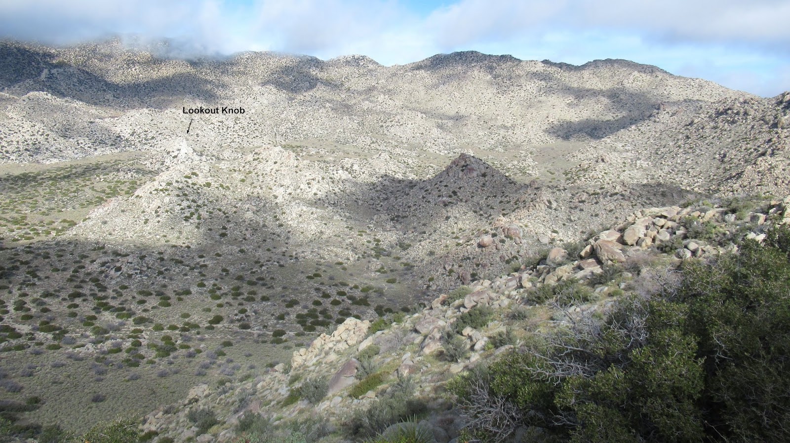
Lookout Knob appeared to rise about 100', smaller than The Thimble a few miles away. Approaching from the south, I couldn't see any clear path that didn't involve significant vertical rock climbing. I wound my way around to the north side where I found the standard route up. It was a chute that looked all class 3. I completed the first 30' or so with good holds on poor rock. This left me on a 4' wide ledge with a bush. The chute continued up but I felt the crux move to go on was more difficult than class 3. Several reports rated it 3+, but I would rate it a solid class 4. There were no good footholds, but a friction placement on the right was possible. The one good handhold was a hand jam in a 5" horizontal crack on the left. I couldn't find any decent hand holds on the right. The move wasn't super exposed, a slip would likely dump you into the bush, but there was maybe a 25% chance you could slide right into a 40' fall. I made a couple of careful pushes off the poor rock with my foot but could not find a handhold for my right hand and slid back into the bush. Then I backed off. I'd rather do that move with some protection in the crack and a harness. The way looked clear above, but I didn't get up there to see. I made another attempt from the east, reaching a notch between a large outcrop and the knob. The next step from there was a friction slab, but I couldn't tell if there was a route to the top so I tapped. (update: I learned later that I tried the wrong gully, was successful on 9/25/2020) Once I climbed down, I wandered north through Hellhole Flat, which is a surprisingly nice area. I was looking for a bone pile I found in 2015, but could not locate it. I'd like to spend more time in Hellhole Flat if I could find an easier way to get there. I came back at Webo from the north and began the long descent. I tried to find easier ground below the ridge, but it ended up being worse, infested with innumerable cholla. I took solid hits in the left thigh and foot passing too close to one. I pulled the last couple of needles out of my leg on the drive home.
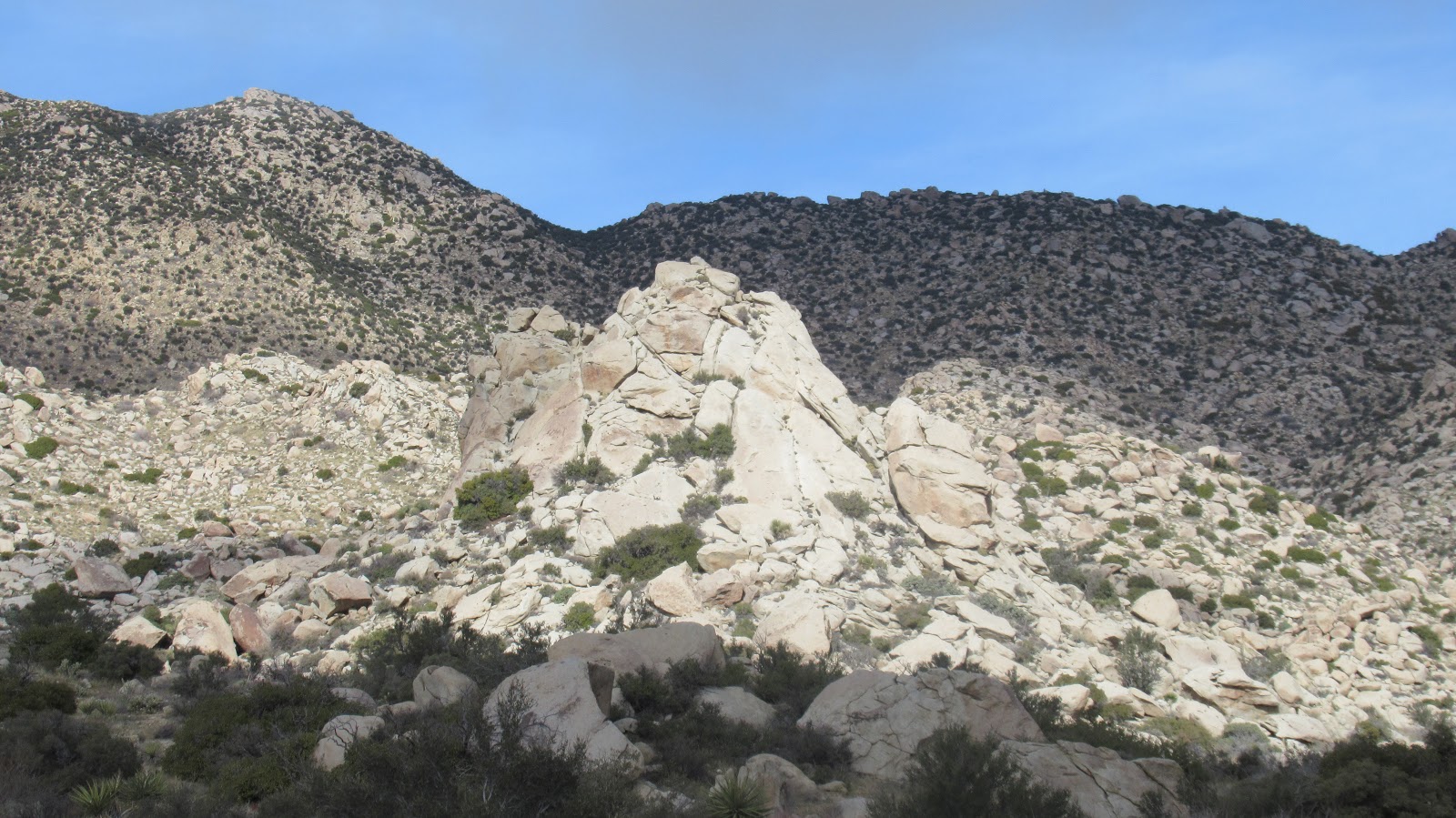
Lookout Knob from the south, best way up is on the other side


Looking down after the first class 3 pitch

Looking up from the ledge, crux move not visible below the frame


Kitty footprint

Webo from the north

Ouch


See also:
Lookout Knob Redux