Monday, July 29, 2019

Signal Mountain, WY

Hiked: 7/28/2019
Distance: Drive up
Summit Elevation: 7720'
Prominence: 880'
Elevation Gain: 0'
Elevation Gain (in Empire State Buildings): 0
Round trip time: N/A
Recommended water: 0 oz.
Parking/Fees: Free
Difficulty: Easy

We left Yellowstone and drove to Grand Teton Nation Park. After checking in to the Signal Mountain Lodge, there wasn't much time left in the day, but enough to make the 5 mile drive up to Signal Mountain. The road is narrow, but paved and easy to drive. At the top is a parking area and a short walk to the high point. There were a few people on top taking pictures. I found a reference mark, but the benchmark was gone. Views were good, but only about 180 degrees due to trees. About a mile below the summit, there is another parking area for "Jackson Point", and a 200' trail to a great viewing spot for the Tetons. I got a fantastic shot of the Tetons at sunset. Worth the stop. The tetons are giant, sharp mountains and the Grand is impressive by any measure.


Dusky grouse(?) hanging out at the summit


Grand Teton on the left, Mount Moran center

Sunday, July 28, 2019

Mount Washburn, WY

Hiked: 7/27/2019
Distance: 5.9 miles round trip on trail
Summit Elevation: 10219'
Elevation Gain: 1553'
Elevation Gain (in Empire State Buildings): 1.2
Round trip time: 2 hours 45 minutes
Recommended water: 40 oz.
Parking/Fees: $35 National Park Fee (Yellowstone) at Chittendon Road
Difficulty: Easy

Leisa and I were able to fit in a hike to Mount Washburn during our visit to Yellowstone National Park. It was named after Henry Washburn, who led an 1870 federal expedition to determine in part whether Yellowstone should be preserved as the first national park. His report about the "wonderland" recommended such action, but Congress didn't make it official until 1872. The two main routes to Washburn are from Dunraven Pass and Chittendon Road. We started on Chittendon because it was one mile shorter. The trailhead parking area is about a mile up the dirt road. Signs there recommended doing the hike before September due to increased bear activity. The grizzly bear factor adds flavor to any hike in Yellowstone. Leisa and I both carried bear spray and had both practiced using it.

It was cool and overcast when we started. The fire lookout on the summit was visible from the trailhead. We had only gone a quarter mile when we noticed two hikers descending off trail to our right. When we reached them, they pointed up at large brown mass on the trail. Our first thought was bear, but as we got nearer, saw a large male bison. He had been sharpening his horns on a tree and a small branch was still stuck to his head. He stepped into the trail to confront us squarely and we had no choice but to drop off trail like the other hikers to get behind him. Once we were out of sight, he lumbered slowly down the trail and that the was last we saw of him.


Snow patches lingered in a few spots as we continued our ascent. The grass was green and surprisingly short. It looked like we were hiking a large golf course with oval snow patches in place of sand traps. The trail does a spiral around the summit ending at the three story fire lookout. You can go inside the lookout to view informational plaques of the surroundings. There was a register notebook with about 50 entries from the day before. It is one of the most popular hikes in the park with nice views. There are also restrooms. The second level is an observation deck, but it limited to 180 degree views. The upper level is a residence and was locked. We rested on top and while, then started down as wind gusted and a few drops of rain hit our faces. On the way down, we met at least a dozen other hikers on the way up. It was a fun, easy hike, with the elevation the main challenge. Leisa set a personal hiking elevation record at 10,219'. The one thing that could have made it better is if we had spotted mountain goats, but the goats were somewhere else.


Tuesday, July 16, 2019

Lily Rock and Suicide Rock

Hiked: 7/14/2019
Distance: 7 miles round trip on trail, use trail, and cross country
Summit Elevation: 8000' (Lily), 7528' (Suicide)
Elevation Gain: 3720'
Elevation Gain (in Empire State Buildings): 3.0
Round trip time: 6 hours 15 minutes
Recommended water: 88 oz.
Parking/Fees: Adventure Pass at Humber Park
Difficulty: Strenuous (combined)

I knew I wanted to climb Lily Rock (aka Tahquitz Rock) after looking down on it from Marion Mountain. It is a giant chunk of granite with popular rock climbing routes. There is a hikers trail that goes up to a saddle behind it, followed by a class 3 scramble for the summit. It was a last minute thing so I didn't do much planning. From Humber Park at 6:45 AM, I descended to the Ernie Maxwell trail and took it to the ascent gully about a half mile down trail. Along the way, I passed several climbers' trails marked with pink ribbon. The ascent gully had some cairns, and use trails branching off on both sides. I stayed left above the gully and hiked through a lot of dead trees. The slope was very steep and loose. I might have done better in the gully. I reached the right side of the saddle and did a short down climb to get to the base of the summit looming 160' above. I explored left then right, blazing my own route through a dead tree and up a curved block with a 2' crack. Next was a very exposed move across the crack to a big slab. The holds were solid and after a short pause to absorb the adrenaline hit, I continued up to the summit. I found a cement marker on top reading "HI 10" (?) and great views all around, but no register. I could hear climbers yelling to each other on the vertical face below, but didn't see anyone. I looked for an easier way down and followed a low class 3 gully which would have been the left side going up. It was much better, with only a single exposed 4' ledge past a bush. The 4' ledge was slightly angled down and there was a down climb there if you prefer not to cross it. I learned later this was the main route. I returned across the saddle and started plunge stepping down. While it was 2 steps forward, 1 back going up, it was 2 steps down then slide another step going down. At around 7500', I took a big step directly over a curled rattlesnake. Another adrenaline shot. It was thankfully still cool out and I was under full shade. The snake moved slowly and evenly uphill toward a tree, not bothering to rattle a warning. It was a juvenile probably waiting for the sun to break through the pines. The rest of the descent was low drama and I returned to the truck to reset for a trip to Suicide Rock. By this time, the parking lot was full.


Lily Rock (Tahquitz Rock), a gorgeous hunk of granite


Start of Ernie Maxwell trail


Ascent gully


Lily Rock from the saddle


Tahquitz Peak from the saddle


Blue route is standard, I went up the yellow route


Through the dead tree


Up this rock with the crack


Across the gap to the final slab, good hold below not visible


Consequences of a fall


Summit cement mark


Looking down on Suicide Rock below


Southern pacific rattlesnake I stepped over


Summit and snake


360 view from Lily Rock summit

The official trail to Suicide Rock is about 7 miles long, but I had read about a short climbers trail that drops off the side of the road not far below Humber Park. I took a break at the truck then followed the paved road down by three green water tanks. I found a small "climber trail" sign and dropped down the trail to cross the creek. It emerged onto a private paved road (with hike through granted), then turned into a dirt road and finally a single track below Suicide Rock. The trail is unmaintained and several other use trails splinter off. I just continued up. As you approach the tall granite slabs, the trail has sections of class 2. Here the trail goes right and follows below the slabs. I passed multiple parties climbing various routes. As the slabs end, you reach the ridge and intersect the main trail. I took the main trail to the look out point with fantastic views. Then, I followed a use trail to the less impressive summit with small boulders, surrounded by trees. I returned down the climbers trail, then back up the road to the truck. Since I parked at the top of the Humber Park circle, I added some unnecessary gain to both hikes. Each hike alone was moderate, but combined added up to pretty solid day.


On the trail below the Suicide slabs


Two climbers on route


Lily Rock and Tahquitz Peak from the lookout


Summit of Suicide Rock


Looking up toward San Jacinto


New plate is easier to understand than the old one


Sunday, July 7, 2019

Pallett Plane Crash Loop

Hiked: 7/5/2019
Distance: 13 miles round trip on trail, use trail, and cross country
Summit Elevation: 6709' (Bobcat Knob), 7558' (Goodykoontz), 7760' (Pallett)
Elevation Gain: 4791'
Elevation Gain (in Empire State Buildings): 3.8
Round trip time: 9 hours
Recommended water: 128 oz.
Parking/Fees: Adventure Pass at Buckhorn Campground
Difficulty: Strenuous

Warm weather was ideal for a high country trip in the Angeles. I planned a loop starting on the Burkhart Trail to:
  1. Bobcat Knob
  2. Goodykoontz Peak
  3. Pallett Mountain
I also had a side trip in mind to check out the C-119 Flying Boxcar crash site about a mile off the loop. The C-119 crashed in stormy weather on 9/30/1966 with 4 fatalities. I parked at the end of the Buckhorn campground and got on the trail at 6:45 AM. The nicest part of the Angeles National Forest is this section of high ground along both sides of highway 2. Big pines and big cedars with little underbrush. It rivals the San Jacinto Wilderness for beauty. The Burkhart trail starts by dropping 800' to cross Cooper Canyon, a reminder to save some energy for the climb out. After crossing, I rounded one turn, then started up a ridge toward Bobcat Knob. There was no sign or cairn, just a small clearing. This was the longest ridge (easiest) to get to Bobcat. The route after leaving the trail is all class 1 up to Goodykoontz, but the dirt is loose and the terrain is very steep. This ridge gains 1000' to Bobcat Knob and another 900' to Goodykoontz for a total of 1900' in less than a mile.

The grind to Bobcat Knob was pleasant with an occasional cairn for guidance. Interesting rock formations grew in the canyons on both sides. Bobcat was marked with a rock cairn, but no register. I took a few breaths, then got back to the grind toward Goodykoontz. This seemed like the steepest section of the entire hike, but maybe it just felt like it after climbing up to Bobcat first. A good use trail appeared on the ridge to Goodykoonntz and got better as I went along. I found register cans in between two small outcrops on the summit, no benchmarks. This mountain was named after Frank Goodykoontz who was an active leader in the Sierra Club. A memorial newsletter was in a separate plastic baggie inside the register. It was idyllic on the summit and I was tempted to just nap in the morning sun. But I had a lot on the itinerary, so fueled up and started down the other side in search of the C-119 plane crash.


Girthy!


Cooper Canyon waterfall


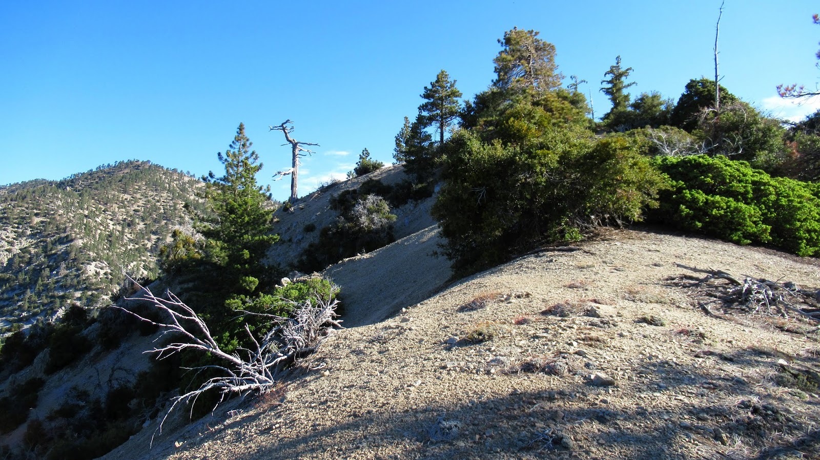
Approaching Bobcat Knob


Pallett from Bobcat Knob


Arriving on Goodykoontz


I dropped to the saddle between Goodykoontz and Williamson, then continued up toward Williamson. Along the way, I found a side use trail that headed toward the ridge with the plane crash. It was unexpected, but saved some gain and distance. The use trail continued along the south, then north side of the ridge and led right into the debris field on the north side. The C-119 apparently crashed near the top of the south ridge sending debris over the top. Most of the plane remained on the south side and large pieces have been washed down the side over time. I focused on the south side, descending about 200' down the slope. There were more parts farther down. There was another crash site farther down the north side, but I didn't explore it to conserve energy. The debris field was large. After some photos, I started back for Pallett with a few small aircraft pieces in tow.


Saddle between Pallett and Williamson


Landing gear?


Part of the tail?


Steep slope, much more debris downhill


I returned on the use trail until I was close to the creek below Pallett. I went straight down, crossed, and started up. I was surprised again to find a good use trail on Pallett. The trail led to the very long and wide summit plateau. I found what I thought was the high point, but no markers or register. Nothing to indicate the summit. I wandered all over the top looking for something that marked the high point, but didn't find anything. I continued down the other side to the Burkhart saddle, rejoining the official trail. I noticed how close Will Thrall was from the saddle and I was still feeling energetic. In the end I decided to skip it so I would have an excuse to come back for Will Thrall and Pleasant View Ridge. It is such a pristine area of forest. On the way out, I met a few hikers/campers. The climb out of Cooper Canyon was mild compared to the slopes I had been climbing all day and presented no challenge. I was pleased at how the hike unfolded and enjoyed every hour.


Pallett in front, Will Thrall behind left, and Pleasant View Ridge behind right


Pallett high point, but no markers or register


Burkhart Saddle


Goodkoontz left, Bobcat Knob right, from the trail