Distance: 14.9 miles round trip on trail and and cross country
Summit Elevation: 10806' (Charlton), 10696' (Little Charlton), 7840' (Poopout Hill)
Elevation Gain: 4197'
Elevation Gain (in Empire State Buildings): 3.35
Round trip time: 7 hours 40 minutes
Recommended water: 156 oz.
Parking/Fees: Adventure Pass
Difficulty: Strenuous
September is my favorite month to visit the San Bernardino Mountains. The bugs of early summer are usually gone and the heat raging in the desert and other local ranges is moderated by the cool air of the high country. Many areas were closed for a couple of years following fires, but almost everything has been opened again (a few roads remained closed). The burden of getting a hiking permit was also lifted last year. A welcome change. My goal today was Charlton, Little Charlton, and Poopout Hill from the South Fork Trail. It was a totally new area for me. I was the only car in the parking lot at 6 AM. There were nice restrooms and the trail starts by crossing highway 38 heading south. I took off in twilight.
The trail was in great shape. The first thing I noticed was the severity of the burned trees. Most of the forest on this side had burned up to about 9000'. Less than a mile up the trail was Horse Meadows, where two cabins and a bench had survived the fire. The trail crossed a dirt road above Horse Meadows and another half mile got me to Poopout Hill. There was a camping spot there, but the low summit boulders had no markers or register. Poopout Hill was only a 5 minute diversion. The South Fork Trail is on the north side of the high spine of the mountains and remained in shadows all morning. Combined with the elevation and a breeze, the temps dropped into the 40Fs and I had to put on gloves. A dramatic change from the high 90Fs on Grunt two weeks ago. From this point to Dollar Lake Saddle at 10000', the trail makes long, swooping switchbacks. The grade is gentle up to the Dry Lake cut off, then gets steeper, but never uncomfortably so. However, the combination of distance and increasing elevation make it a grind. The last mile before Dollar Lake Saddle offered phenomenal views of San Gorgonio and Charlton. The northern slopes of Charlton looked quite rough from the trail. I took a break at Dollar Lake Saddle to refuel, staying in the sun and adding another light layer. I also cached two bottles of water for the return trip.


Poopout Hill summit

San Gorgonio

Charlton Peak

The crux of the hike was the east ridge of Charlton. It's 800' of steep class 1 with occasional light class 2 on nice granite. A trace of a use trail appeared and faded. The pines are sparse enough that they don't really get in the way, but I was moving slowly on the ridge above 10k. The summit area was long and broad and the trees blocked views 180 degrees to the east. There was a broken ammo box bolted to a rock with a pair of red cans inside. The register was brand new, only placed a couple of weeks earlier. I found no USGS marks. After signing in, I enjoyed the sharp view of the north side of San Gorgonio and Jepson. Gorgonio was only 800' higher than Charlton, but it looked much higher due to bulk. After some photos, I started down toward Little Charlton, barely visible over the trees. When I got near the saddle between the two, it opened up and I got a good look up the rocky ridge. It was only 100' gain to the top of Little Charlton. Any of three small bumps could have been the high point. The second bump had a broken ammo box, but no register, probably the official summit. My Garmin GPS showed the third small bump as the summit, but the GPS topo has shown errors in the past. To be safe, I went over all of them on the way down the west ridge to meet up with the San Bernardino Divide Trail. I took the trail around the south side of Charlton back to Dollar Lake Saddle. I picked up my water cache, then set a quick cadence to make up for my slowness on Charlton. On the way down, I met my a few backpackers heading up for the weekend, including two USFS rangers making their way to Big Tree Camp. They said it was a remote area and not very popular. I hadn't heard of it and needed to look it up when I got home. My final rest stop was at Horse Meadows to check out the cabins. One was locked and one looked like it was built for stable gear. I was snacking on the picnic table when I heard a loud crash from the brush nearby. My first startled reaction was bear(!) but I think it was just a burned limb that had fallen from one of the trees. Either way, it encouraged me to get back on the trail and finish. This hike was right in my sweet spot between 12-16 miles.

Climbing up the east ridge

Charlton summit


Looking south

On the way to Little Charlton

Little Charlton summit

Exploded pine


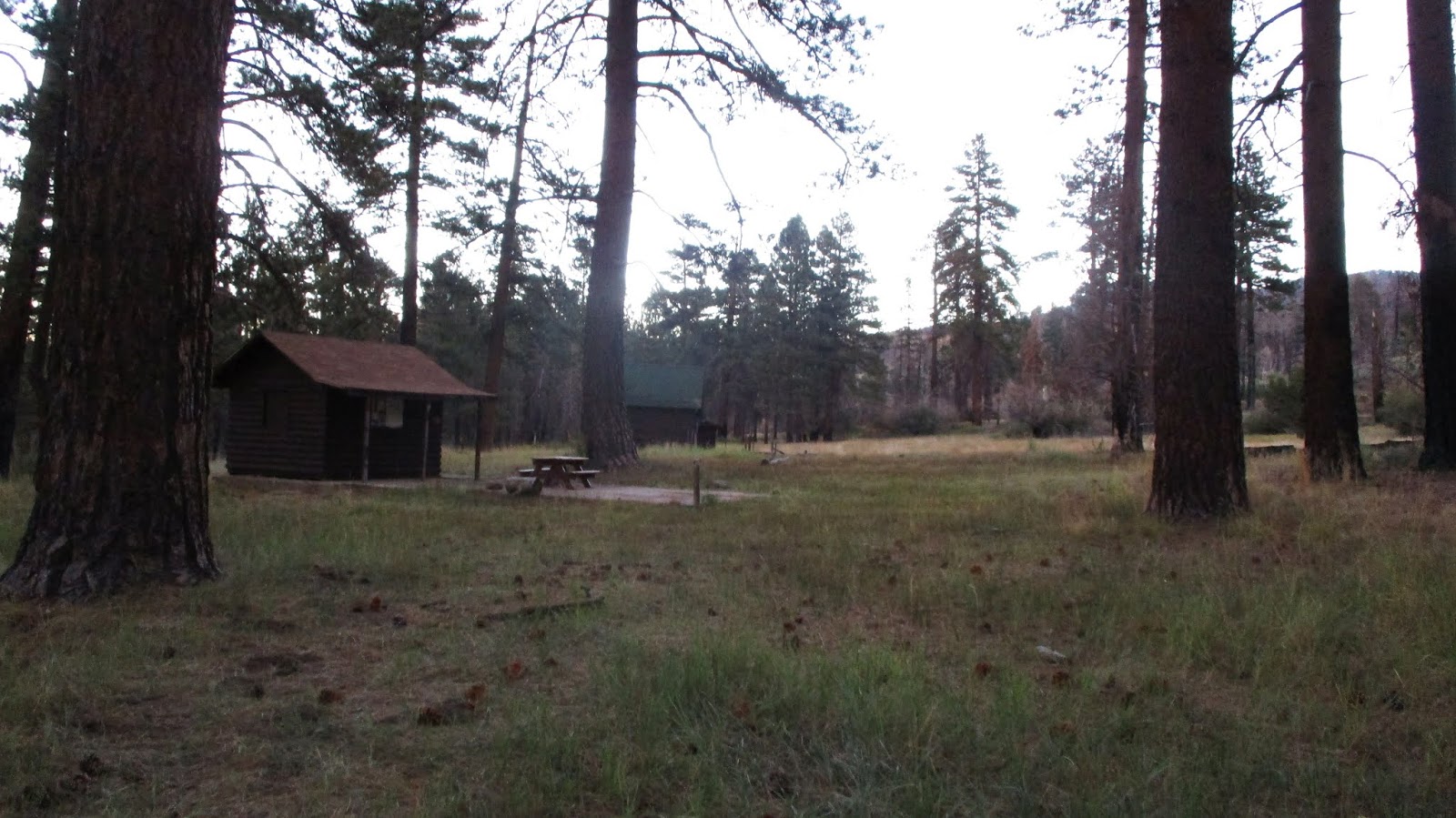
Cabins at Horse Meadows


Nice lollipop teke. Fall is the best time to be out. Ima half to get me some San Berdoos one of these days. ~wildsouthland~
ReplyDeleteMadison,
DeleteAgreed on Berdoos in the Fall. Those 10Ks all look close together on the map, not so close after slogging up there, haha.
I like the way you think (& write), Tekewin. Most bag it coming downridge from SG/Jepson. Solid effort!
ReplyDeleteGloop,
DeleteThanks. Having gone up from Dollar Lake Saddle, I think it would have been better to loop the other way to get at least half the gain on the trail. I was gulping air on the east ridge.