Hiked: 7/8/2018
Distance: 12.5 miles round trip on trail
Summit Elevation: 7124'
Prominence: 1563'
Elevation Gain: 2530'
Elevation Gain (in Empire State Buildings): 2.02
Round trip time: 6 hours 30 minutes
Recommended water: 96 oz.
Parking/Fees: Adventure Pass (signed)
Difficulty: Strenuous
Sidebar on difficulty: It was strenuous because I carried a rope and gear adding 10 pounds to my pack. If I had left the rope at home, it would have been moderate, but I probably would have skipped the summit block.
Pacifico Mountain had been on my radar a while. It had respectable mileage, big prominence, and a summit full of fun looking granite boulders. The highest summit block was a twenty footer that Bob Burd rated as class 3 but Summitpost and most other people rated as class 4. I could not tell from photos alone, so it gave me an excuse to dust off the rope gear and brush up on my rope skills. We were also in the midst of a record smashing heat wave and a heat advisory was in effect. The high at the trailhead was supposed to be 91F and I had something to prove in the heat after making mistakes the previous month coming down from Big Iron.
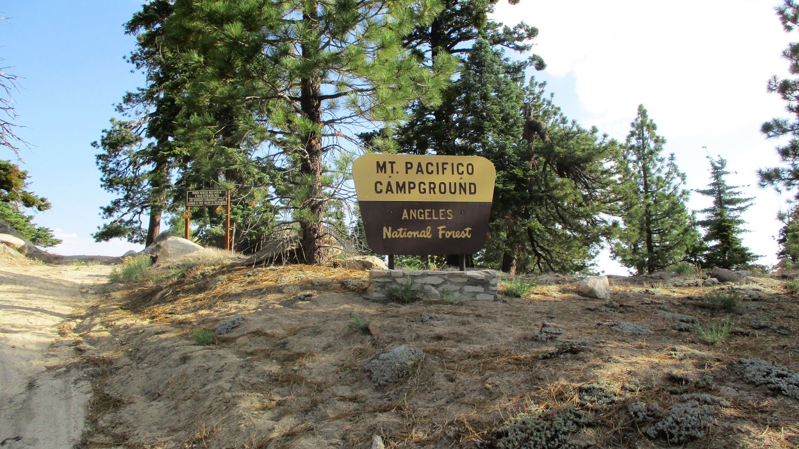
I arrived at the Mill Creek Summit at 5:45 AM and was the only car in the Pony Park Day Use parking lot. It was 73F. I started up the sandy Pacifico Mountain Road looking for animal prints. The only prints I found were from a horse (all the way to the summit) and occasional deer prints. No signs of carnivorous predators. The road stays below the major ridge most of the way, providing excellent shade in the early morning. There were good views of the front range classics. As I neared the top, pines started to dominate. Below the summit, the road intersects the PCT. There was a steep use trail up the west ridge, but I was lugging a rope and gear and decided to take the winding road around. The summit smelled strongly of pine and there were no campers or picnickers around. I had the entire mountain to myself. Plenty of tables were scattered around and there were two bathrooms on the summit. Delightful.


Mill Creek from the road

Round Top (left) and Granite (right)


Major summit blocks, highest on the left

A pipe on a lower summit block

Highest summit block from the side


Lower summit area

The elusive Pacifico register from 1992

Benchmark on a flat boulder behind the summit block
I did a quick tour of the granite summit blocks, then focused on the highest one. I am pretty conservative with YDS ratings, but at first, I thought maybe Bob was right. I saw some good holds on the block. When I actually got up on it, I changed my mind. There were three good holds leading directly to the pole sticking out on top (see image below). For it to be class 3, I think it needed a foothold somewhere in the orange area (see image below), and there was nothing good. There was another good hold on the right, but again, no foothold to support moving that way. A friction move was needed to reach the third hold and I didn't want to make the move unprotected. I came down and unpacked the rope and gear. After slinging it over the top, I anchored it to a pine tree with some girth. I protected myself with two prusiks and got back on the rock. I didn't use the rope as aid, only protection. I couldn't find an acceptable place for my right foot, so I switched to my left foot for the friction move. Once I got the third hold, the rest was easy. After taking a few photos, I rappelled down the main block and the one in front of it. I changed back into my hiking boots and climbed the other class 3 blocks. I found empty pins on all of the them. There was a Dept of the Interior benchmark on a flat boulder behind the summit block, but I didn't find any of the reference marks. The register was in a pair of HPS red cans wedged deep between slabs behind the summit block. I signed in, noticing that there weren't many signatures. It was hard to see and I suspect a lot of people never found it. I moved it to a more conspicuous place in the wedge so it would be easier to find.


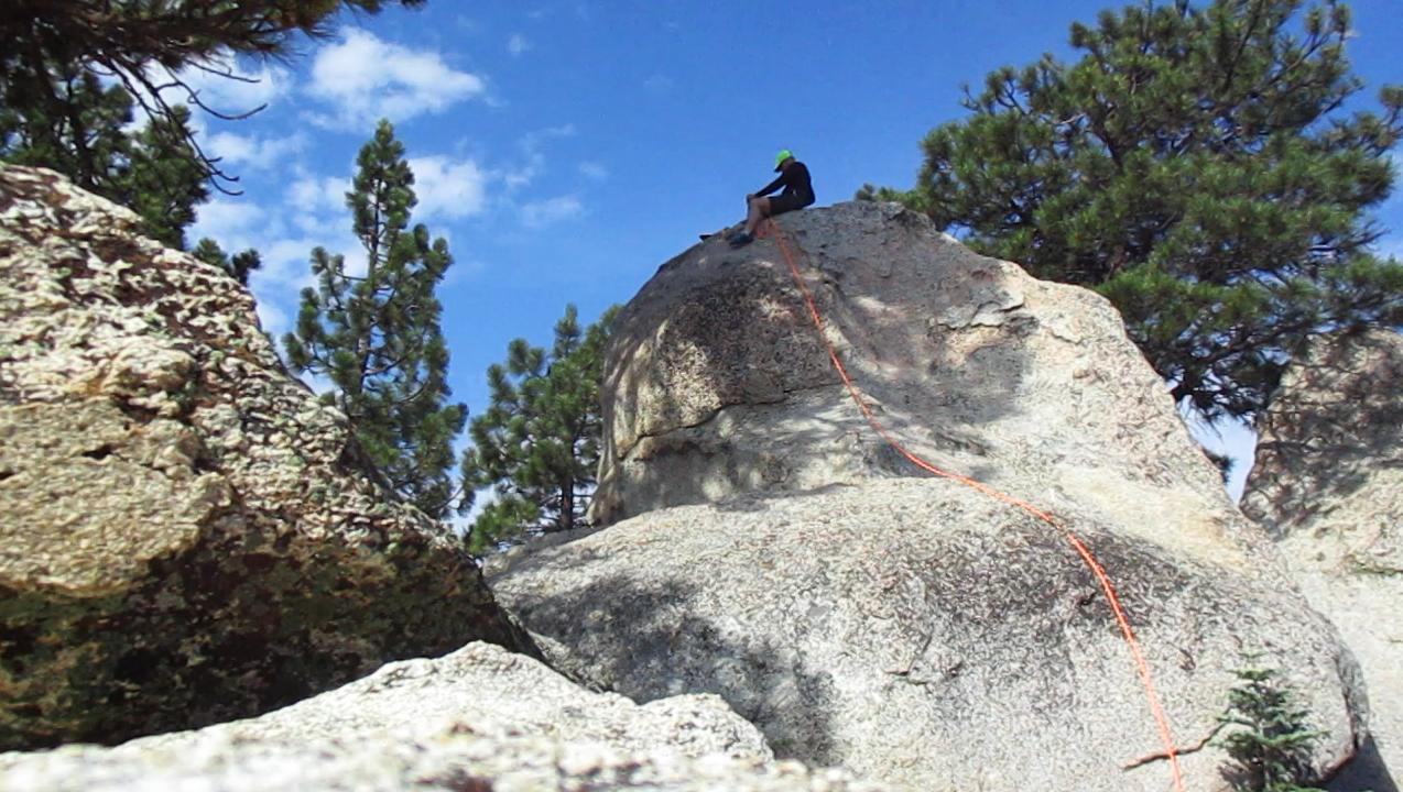

Anchor on the pine tree, register was under the big slab on the left,
where the rope goes over the rock

Ascent side

Rappel
I spent almost an hour and a half on the summit, most of that time juggling rope gear. I took the steep west ridge use trail down to intersect the PCT. It was nice to have different scenery on the way back. There were a lot of burned areas but otherwise nothing remarkable. The heat built steadily as I descended, but I was in control. I had a lot of water left, including one bottle I had frozen the night before. It had melted but was still cold. I took a couple of short breaks in the shade on the way down, making it back about an hour before my plan.


Pacifico from the PCT

Cruising down the PCT

Charred

There's something about Mary


No comments:
Post a Comment